
Free Part 107 airspace lesson
Work through one concept at a time, with a short explanation, a large visual and a question to check your understanding.
Reading airspace heights
A free section of a Learn lesson. Follow the steps, compare the chart with the 3D volume, then check the height shown.
- 1. Boundary
- 2. Ceiling
- 3. Height references
- 4. Check
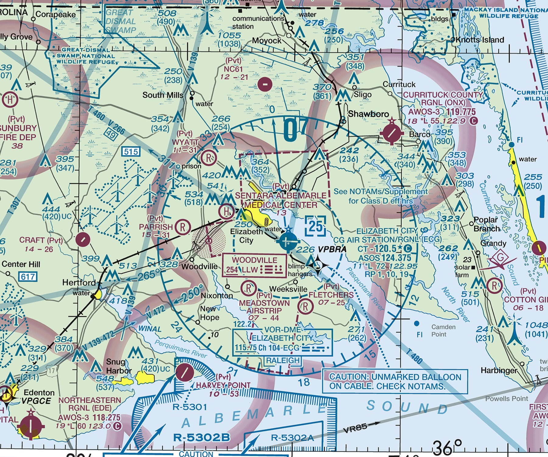
Original FAA chart · 3 September 2026. The 3D boundary is approximate and its height is exaggerated. Assume Class D is active for this exercise.
Enlarge the chart and read the source
FAA Washington Sectional, 3 September 2026 · FAA Aeronautical Chart User’s Guide
This dated excerpt and model teach chart interpretation. They do not provide flight authorisation or current operational information.
Read the boundary
The small dashed blue line marks the Class D boundary around Elizabeth City airport. The much larger circle with compass markings belongs to the VOR. The airspace begins at the surface.
Guided lessons
The course covers 60 skills. Each lesson introduces the idea before asking you to apply it.
Interactive visuals
Explore airspace in 3D, read charts and adjust controls to see what changes.
Checks and explanations
Answer a question, then read the explanation and its source.
Resume your learning
Your account saves your place and completed steps so you can return on another device.
These demonstrations are free. Create your account for full course access from $9.99 USD per month, or $39.99 USD once for 12 months.